Back to Travel Guide

History of Curaçao

Five centuries of history shaped Curaçao into one of the most culturally complex islands in the Caribbean — a story of indigenous peoples, colonial powers, and resilient communities.

Curaçao's history is layered and complex. From its earliest Arawak inhabitants to its role as a major slave trading centre, from colonial wealth to hard-won autonomy, the island's past is written in its architecture, language, music, and people. Understanding this history transforms your visit from a beach holiday into a truly meaningful experience.

The Arawak People

Long before Europeans arrived, Curaçao was home to the Arawak (Caiquetío) people, who migrated from the Venezuelan mainland around 2500 BCE. They were skilled fishermen, farmers, and artists who left behind petroglyphs in the Hato Caves and at sites across the island. The Arawaks called the island 'Kòrsou' — the origin of its current name. They lived in small settlements, grew maize and cassava, and traded with neighbouring islands. When the Spanish arrived in 1499, an estimated 2,000 Arawaks lived on the island. The Spanish initially found little of value and used Curaçao mainly as a ranching outpost, eventually deporting most of the indigenous population to Hispaniola as forced labour.

💡 Tip: Visit the Hato Caves to see Arawak petroglyphs dating back over 1,500 years — the oldest surviving art on the island.

Dutch Colonialism & the WIC

Dutch Colonialism & the WIC

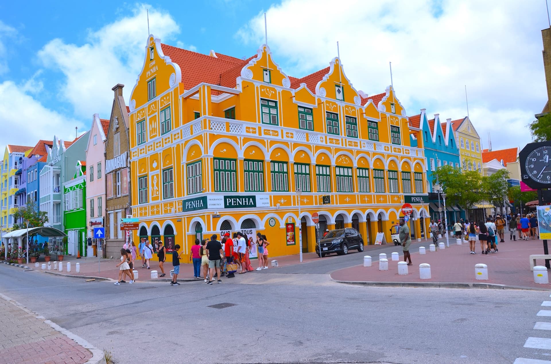
The Dutch West India Company (WIC) seized Curaçao from Spain in 1634, recognising the island's strategic value as a natural deep-water harbour in the heart of the Caribbean. Under Dutch rule, Curaçao became one of the largest slave trading centres in the Western Hemisphere. Between 1650 and 1863, tens of thousands of enslaved Africans were brought to the island — many were 'transhipped' to plantations across the Americas, while others were put to work on Curaçao's own plantations and salt pans. The WIC built Fort Amsterdam, warehouses, and the distinctive Handelskade waterfront that still defines Willemstad's skyline today. The wealth from trade built the grand mansions of Scharloo and Pietermaai.

💡 Tip: Visit the Kura Hulanda Museum in Otrobanda for the most comprehensive telling of Curaçao's role in the slave trade.

The Landhuizen (Plantation Houses)

The Landhuizen (Plantation Houses)

Scattered across the island are some 65 landhuizen — plantation manor houses that tell the story of Curaçao's colonial economy. Unlike the sugar plantations of other Caribbean islands, Curaçao's arid climate meant plantations focused on smaller crops, salt production, and livestock. The landhuizen range from ruins to beautifully restored estates. Landhuis Chobolobo houses the Senior & Co distillery where genuine Blue Curaçao liqueur is still made. Landhuis Ascension hosts cultural events. Landhuis Knip, near Grote Knip beach, is where the Tula revolt began in 1795. Each landhuis has its own story — of wealth, exploitation, resistance, and survival.

💡 Tip: Landhuis Chobolobo offers free tours of the Blue Curaçao distillery, including tastings. Open Monday to Friday.

The Papiamentu Language

Papiamentu is Curaçao's mother tongue — a creole language born from the collision of Portuguese, Spanish, Dutch, West African languages, and Arawak words. It developed on the plantations and in the streets as a common language between enslaved Africans, their colonial masters, and Sephardic Jewish traders. Today, Papiamentu is an official language, taught in schools, used in government, and the first language of most Curaçaoans. It's one of the most successful creole languages in the world, with a rich literary tradition, newspapers, and music. The language itself is a living monument to the island's multicultural history — every word carries echoes of the people who created it.

💡 Tip: Learn a few phrases: 'Kon ta bai?' (How are you?), 'Mi ta bon' (I'm fine), 'Ayo' (Goodbye). Locals will light up when you try.

Mikvé Israel-Emanuel Synagogue

Founded in 1651 and housed in its current building since 1732, Mikvé Israel-Emanuel is the oldest continuously used synagogue in the Americas. The Sephardic Jewish community in Curaçao was among the largest and most influential in the New World, having fled the Inquisition in Portugal and Spain via Amsterdam and Recife, Brazil. The synagogue's sand-covered floor — variously said to symbolise the desert wanderings, muffle footsteps during the Inquisition, or represent the Promised Land — remains one of its most distinctive features. The adjacent Jewish Cultural Historical Museum houses Torah scrolls, menorahs, and documents dating back centuries.

💡 Tip: The synagogue is open for visits Sunday to Friday (small admission fee). Services are still held on Shabbat — visitors are welcome.

Tula's Revolt of 1795

On August 17, 1795, an enslaved man named Tula led the largest slave uprising in the history of the Dutch Antilles. Starting at Landhuis Knip on the west coast, Tula and fellow leader Bastiaan Carpata organised about 50 enslaved workers to refuse to work and march across the island demanding freedom. The revolt lasted over a month before being brutally suppressed by the Dutch authorities. Tula was captured, tortured, and publicly executed. Today, he is honoured as a national hero — August 17 is an official holiday (Dia di Lucha pa Libertat), and a monument to Tula stands at the Rif Fort in Willemstad. His fight for freedom predated the Dutch abolition of slavery by nearly 70 years (1863).

💡 Tip: Visit the Tula monument at Rif Fort and Landhuis Knip where the revolt began. August 17 commemorations include cultural events across the island.

How the Landhuizen Were Built

Brick reached Curaçao only as ships' ballast and cost about six times as much as local stone, so from the start builders used what the island offered. Along the shore lay coral rubble, worn smooth and rounded by the surf, which masons gathered for walls; inland they cut breuksteen, a rougher, more angular limestone hacked or blasted from the terraces. Houses near the sea, on Pietermaai for instance, tend to be coral stone, while most country landhuizen are breuksteen. The stones were so irregular that load-bearing walls came out 40 to 50 centimetres thick, a matter of masonry rather than deliberate climate design. Plaster and mortar largely came from the same rock. Coral and limestone were burned into lime in field kilns, temporary stacks of alternating wood and stone that burned for days. The trade consumed so much firewood that an 1826 ordinance banned lime-burning without government permission. Around 1900 a few permanent masonry kilns appeared; remains still stand near the Spaanse Water and at Jan Thiel. Most construction timber, chiefly yellow pine and pitch pine, came from North America from the eighteenth century on; by the early 1800s a whole order could arrive sawn to size. Then, in the 1920s, a local concrete took over: beton bashá, cement mixed with finger coral, poured into shallow bands of formwork, one strip at a time, working upward as each layer hardened.

💡 Tip: On an older plastered wall, faint horizontal seams spaced roughly 20 to 30 centimetres apart are the telltale sign of beton bashá, each line marking where one pour hardened before the next went on.

Four Curaçaoan Building Styles

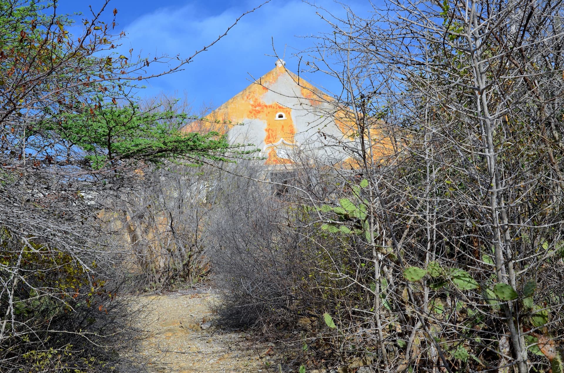
Between the seventeenth and nineteenth centuries, four building styles took shape on Curaçao, named a few decades ago by the island's architecture and art historians. They overlap by decades, but each left its mark in the gables. The earliest, the Curaçao Dutch style, lasted into the first half of the eighteenth century: a plain top gable finished with a small triangular pediment, a detail that came via the Netherlands from the Italian Renaissance. Ascencion and Groot Santa Martha still wear it. The eighteenth century produced Curaçao Baroque, as builders reworked European forms in a local way. Its shared trait is the curved gable line, best known in the form that swings in and out, while arcades of arches on columns line many galleries. Savonet, Habaai and Zeelandia carry these curves; at Brievengat they run the full width of the façade. The nineteenth century turned first simpler, then more formal. In its early half, the neo-Curaçao Dutch style reduced the gable to straight sloping lines, often with a ventilation opening, sometimes ringed by plasterwork, as at Knip and Klein Santa Martha. From the 1850s, neoclassicism, shaped by Europe and the United States, appeared first in town and later at country houses such as Cerito, with symmetrical façades and broad pediments on sturdy columns. Floor plans recur across all three centuries, so it is the gable that dates a house.

💡 Tip: When you pass a landhouse, look at the top gable first: curved lines usually point to the eighteenth century, straight sloping lines to the early nineteenth.

The Werbata Map of 1911

Curaçao's most accurate historical map began with a water problem. In the early 1900s the island's farms were struggling through persistent drought, and from 1904 governor De Jong van Beek en Donk pushed a programme to repair dams neglected since emancipation and add a series of new ones. Placing a dam well demands exact knowledge of heights and slopes, and existing maps showed elevation only as washes of tint. So in 1906 J.V.D. Werbata, a topographer of the Topographical Service of the Dutch East Indies, arrived with a full kit of measuring and drawing instruments to survey the whole island. He finished the fieldwork in 1909, first training the Curaçaoan Jonckheer, who went on to chart the other Dutch islands. The result appeared in early 1911: eighteen colour sheets at 1:20,000, published by J. Smeulders & Co in The Hague. No later topographic map has surpassed their accuracy, and because Werbata printed the label landhuis on his sheets, they remain in principle the deciding source for which country houses genuinely count as landhuizen. Werbata had predecessors: an 1816-17 manuscript map by captain-engineer H.J. Abbring marked the landhuizen with red dots, an 1826 triangulation-based military map showed the island's true shape for the first time, and an 1836 chart published by the widow Gerard Hulst van Keulen in Amsterdam numbered and named more than a hundred landhuizen.

💡 Tip: If you spot a framed antique map in a restored landhuis or museum, check the margin for Werbata's name and the 1911 date; find them and you are looking at one of the eighteen sheets.

Curaçao's Vanished Landhouses

Curaçao once counted more than 150 plantation houses; 78 still stand. The rest were demolished or crumbled into ruin, and a local archaeology working group has since traced the ruins and bare foundations of the lost ones. The decline began quietly: when neighbouring plantations merged, one of the two houses became redundant and was pulled down or left to the weather. Around 1820 the island had 99 independently run plantations; by 1888, roughly 89. Oil changed the pace. From the early 1920s Shell bought up plantation after plantation, for groundwater to feed the refinery, land for workers' housing and harbour works: Koningsplein in 1923, Malpais in 1924, Brievengat in 1927, Groot Piscadera in 1928. Schapeneiland, once part of Koningsplein, was joined to the mainland and carried a dry dock from 1941. The houses themselves survived, but barely: by the early 1950s Shell had decided to demolish the derelict Brievengat. A rescue campaign founded the monuments trust in 1954, which bought the house from Shell for one guilder, and organised preservation began. Some houses were fragments far earlier: the original house at Jan Kok was already a ruin by 1784, probably after a fire, leaving only its storehouse and cellar. Nor have the losses stopped: Toni Kunchi was taken down in 1965 for a housing district, and landhouse Saliña followed in 2013.

💡 Tip: Restored survivors such as Brievengat, saved for one guilder in 1954, give a good sense of what the vanished houses once looked like.

Water on a Dry Island

Curaçao has no rivers, so every plantation lived off the water it could catch and hold. Landhouses were built with rain cisterns filled by a channel system; the cistern walls were often even thicker than the house's load-bearing walls, lined inside with brick and sealed with waterproof plaster. Cisterns served the household, but fields and livestock needed far more, so wells were cut by hand through the hard subsoil, several metres across, with a round masonry rim about a metre high. One type, the pos di pia, had a sloping entrance, sometimes stepped, so people and animals could walk down to the water. Across the rain gullies known as rooien, planters raised dams of earth or masonry so runoff pooled and soaked into the ground instead of rushing straight to sea. An unusually large masonry example stands near Pos Monton on the former Savonet plantation, about three metres high and braced by five buttresses. Where groundwater sat near the surface, shaded orchards called hofjes were planted with fruit and shade trees. Estates with naturally high groundwater became water plantations, selling well water in town, carried in by donkey, above all in dry spells when cisterns ran low. After decades of neglect following emancipation in 1863, the government started repairing old dams and building new ones in 1904, and to site them well had the island properly surveyed for the first time.

💡 Tip: If you hike in Christoffelpark, keep an eye out near Pos Monton for the old buttressed Savonet dam, and many restored landhouses still show their original cistern and well.

Salt from the Saliñas

The shallow lagoons tucked behind Curaçao's southern bays are called saliñas, the Papiamentu word for salt pans, and for centuries they were the island's factory floor. Salt was already being won here in the Spanish period, but it was the Dutch West India Company that built the harvest into a serious export trade. The method was simple and unforgiving. Low walls divided the shallow bay edges into pans of roughly 45 by 30 metres, never more than about 90 centimetres deep. At the start of the dry season, openings in the walls let seawater flood in; the inlets were then sealed and the sun did the work, leaving a layer of salt that was hacked loose, scooped up and stored for export. Until abolition in 1863, this punishing labour fell to enslaved workers. The nineteenth century was the boom era: demand for Curaçao salt ran high from 1832, and by the mid-1840s the plantation of Jan Kok alone had eleven hectares under harvest. The industry declined in the later twentieth century, but the saliñas never quite gave up their shape: around the inner bays, stretches of the old dividing walls still trace the plots. At Jan Kok near Sint Willibrordus, now a designated flamingo sanctuary, and at the salt pans of Jan Thiel, flamingos forage where salt was once raked.

💡 Tip: The viewing platform just east of Sint Willibrordus overlooks the Jan Kok pans; morning or around sunset gives you the best chance of watching the flamingos forage.

The Unreachable Wrecks of Willemstad

Willemstad's harbour holds shipwrecks that even divers rarely, if ever, get to see. The Alphen, a Dutch naval frigate of 36 guns commissioned in 1763, was destroyed at anchor in the Sint Annabaai in September 1778 when fire reached her gunpowder; the blast tore the ship apart and killed some 200 of her crew. Close by lies the Mediator, a steamship built in Liverpool in 1872 that spent four years on the England-India run as the Dahla before being renamed. In July 1884 the German steamer Thuringia rammed her at anchor; she went down slowly enough for everyone aboard to be taken off. Both wrecks sit in the deep, murky shipping channel, which stays closed to diving and snorkelling apart from occasional supervised archaeological work. Two more lost ships lie just east of town. The SS Oranje Nassau, a Dutch steamer built in 1884, ran aground in a storm in 1906 off the stretch of coast now called Bapor Kibra; until recently her boiler could still be seen in the channel beside the Sea Aquarium. Deepest of all is the Stella Maris, a 90-metre freighter seized in a drug-trafficking case and sunk as an artificial reef in the mid-1980s. She slid down the slope into water far beyond recreational limits and was lost for decades, until a technical dive team found her again in 2006, resting on her starboard side at more than 120 metres. The reef above still carries her name.

💡 Tip: Crossing the Sint Annabaai on the Queen Emma pontoon bridge or the free ferry between Punda and Otrobanda takes you over the same water where the Alphen and the Mediator went down.

About our Seafari safaris

How do I book a Seafari tour?+
Book directly on seafariadventurescuracao.com — select your tour, pick a date, and fill in your details. Book now, pay later: no payment upfront, with full payment due 14 days before your tour. No booking fees. Cruise passengers: we match your ship schedule and guarantee on-time return.
What's included in a Seafari tour?+
All our tours include professional snorkeling equipment, drinks (soft drinks, beer, signature Seafari cocktail), snacks or lunch depending on the tour, sun shade on the boat, and a multilingual guide. Snorkel vests are free on request. You only bring swimwear, towel, and sunscreen.
What if the weather is bad?+
Our Rupert 50 RIB handles moderate chop comfortably. For genuinely dangerous weather we reschedule or refund 100%. You get a call by 7 AM on the tour day if we need to adjust. Curaçao sits below the hurricane belt and the trade winds are steady, so weather cancellations are uncommon; we will publish our actual cancellation record once we have one.
Is Seafari suitable for children?+
Yes. Children 6+ are welcome on all standard tours. The boat has stable RIB hulls (no seasickness for most), life vests in all sizes, and our guides are trained in family snorkel introductions. For children under 6 we recommend a private charter for flexibility.
Can I book a private charter?+
Yes — the Rupert 50 is available for private charter for groups of 2-30: half-day $3,500, full-day $6,500, sunset $2,950 — the whole boat for your group. Design your own route, pick your own stops, set your own pace. Contact us via the Private Charter form and we'll confirm a fixed price within 24 hours.
What's the cancellation policy?+
Free cancellation up to 24 hours before departure — full refund, no questions asked. Within 24 hours, or a no-show, is non-refundable. If WE cancel (weather, mechanical, safety): 100% refund or free reschedule, your choice. Groups of 10+ and private charters have a 72-hour window. Travel insurance is recommended for cruise passengers.
Discover it by boat

The best way to experience Curaçao's coastline is from the water. Our sea safaris take you to the island's most beautiful spots — places you can only reach by boat.

View Our Tours